How WWI got Nat Geo into the map business
Published: 19 September 2025
By Erin Blakemore
via the National Geographic website

NationalGeographic_633183
National Geographic Society maps supply a backdrop for a meeting between Franklin D. Roosevelt and Soviet politician Vyacheslav Molotov during World War II. Photograph by U.S. Gov't Navy
Our first in-house map was produced during World War I. By the Second World War, the White House was asking for them by name.
Poland. Denmark. Norway. Belgium. As Hitler’s troops marched across Europe in wave after seemingly unstoppable wave, nations toppled, the conquered states’ borders melting into Germany.
But thousands of miles away, a group of committed National Geographic cartographers had different marching orders: Don’t change the map of Europe until the war is over. Leaving borders in place would show what was at stake.
The National Geographic Society had been making maps since the First World War. National Geographic Society president Gilbert Grosvenor had not only anticipated the conflict, but also knew that National Geographic readers would need maps to understand it. Dissatisfied with the first map he commissioned from an outside company, Grosvenor established a map department within the Society in 1915.
Nat Geo was now in the map business—and the inclusion of maps in its magazine piqued readers’ interest.
The first map produced in-house, 1918’s “Map of the Western Theatre of War,” was the most comprehensive of its kind—and set the stage for decades of mapmaking to come. These maps would later be gifted to heads of state who needed detailed maps of territories in Europe and the Pacific.
“In addition to how valuable the military found the Society’s maps, I think that Society members must have studied these maps in a way that is a bit difficult for us to appreciate today,” says National Geographic Society senior archivist Cathy Hunter. She sees the maps as more than dry listings of boundaries and place names. “So many would have known someone who was serving overseas in places that Americans had never heard of.”
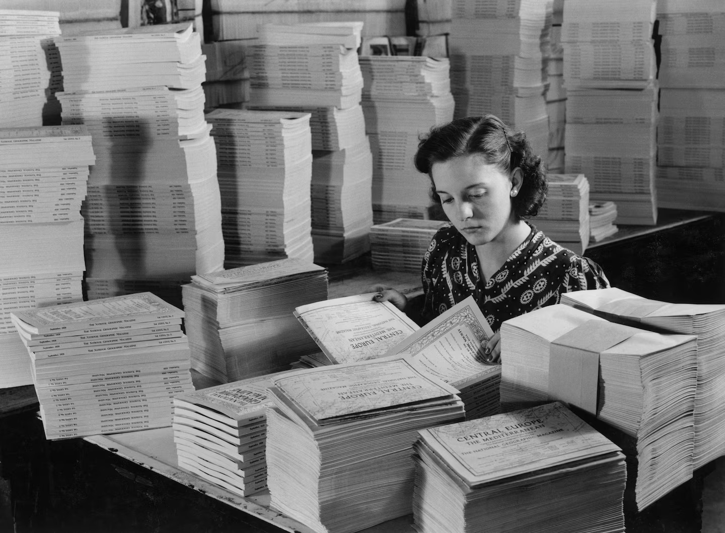
A million and a quarter map supplements for one month of National Geographic magazines are folded by machine and then inserted by hand. This is the map of Central Europe and the Mediterranean, which reached members immediately after the outbreak of the war.
Photograph by Paul Pryor, National Geographic Image Collection
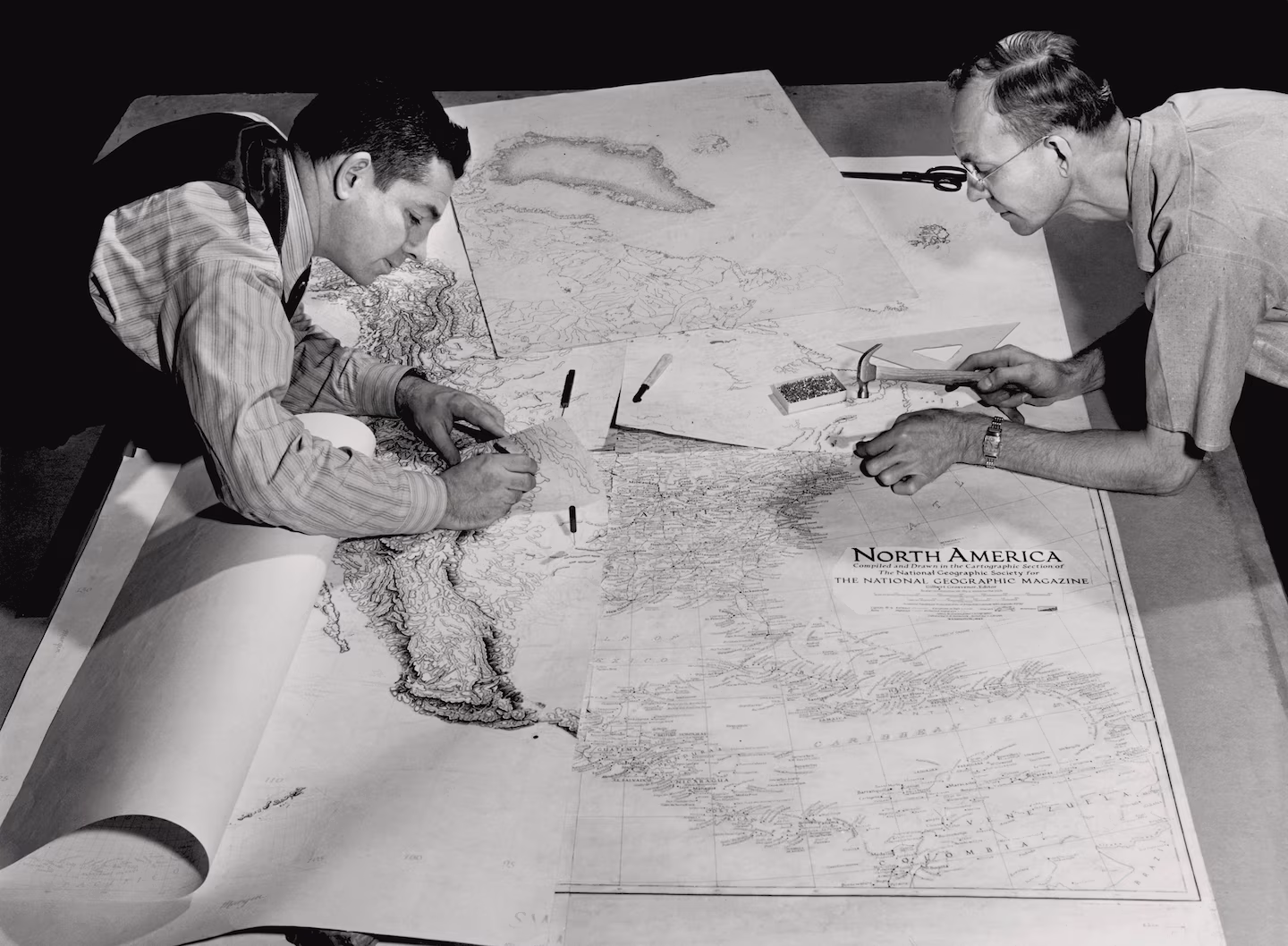
One sheet (lower right) shows parallels, meridians, place names, railroads, and other works of man on the continent. Another shows relief by myriad tiny pen strokes—450 hours of work. A third shows drainages; a fourth the roads. Drawings are made in sections so several experts can work on them at once.
Photograph by B. Anthony Stewart, National Geographic Image Collection
Mapping World War II
By the time Nazi troops invaded Poland in 1939, National Geographic was internationally known for its maps. Chief cartographer Albert H. Bumstead, who had honed his mapmaking skills as an employee of the U.S. Geological Survey, had helped push the Society to the forefront of the international mapmaking trade thanks to inventive new mapping techniques.
→ Read the entire article on the National Geographic website here:
External Web Site Notice: This page contains information directly presented from an external source. The terms and conditions of this page may not be the same as those of this website. Click here to read the full disclaimer notice for external web sites. Thank you.
